POWERFUL SOLAR FLARES IN PROGRESS: New sunspot 4366 has an unstable 'delta-class' magnetic field that is crackling with strong solar flares. Earlier today it produced a M7-X1-M6 flare that collectively lasted more than 6 hours. X marks the spot in this snapshot from NASA's Solar Dynamics Observatory:

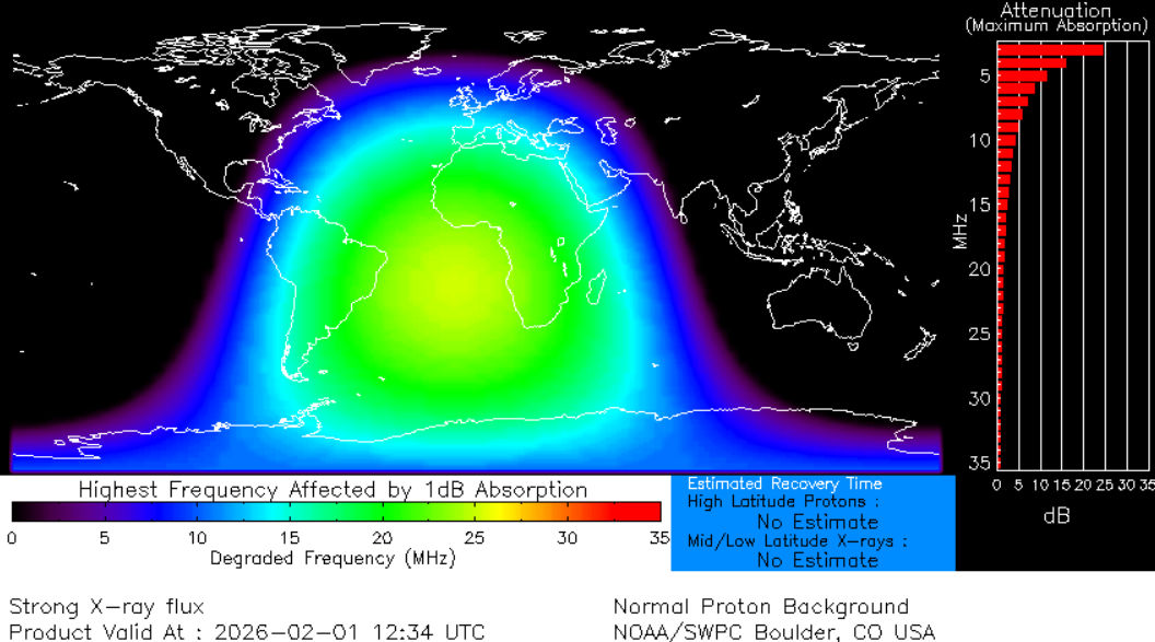
Extreme ultraviolet radiation from the flare ionized the top of Earth's atmosphere. This, in turn, caused a shortwave radio blackout centered on the South Atlantic, touching the edges of South America and Africa: map. Ham radio operators may have experienced loss of signal below 20 MHz for hours around 1230 UTC.
Is a CME heading for Earth? The jury's still out. First-look data suggest "no," but this conclusion may be overturned by fresh data from NOAA and SOHO coronagraphs. Stay tuned.
Source: spaceweather.com


.png)


.png)
