Three day forecast and the coastal flood advisory. Unfortunately the little rain we’ve gotten has not put a dent in the drought. Nor has it done anything to help put out the marsh fires burning underground.


Three day forecast and the coastal flood advisory. Unfortunately the little rain we’ve gotten has not put a dent in the drought. Nor has it done anything to help put out the marsh fires burning underground.
It’s going to be rainy for a few days. It’ll clear out Wednesday. Drive safe! #SELAWX

9/7/23 5:25pm Storms diving South across the area with a cold front. Local flooding a possibility. Stay weather aware! #SELAWX

RAPID INTENSIFICATION SCENARIO! The hurricane specific models had locked on with the formation of a center of circulation and it’s not good. We will see a CAT3 or 4 major hurricane in the Gulf of Mexico making landfall on the Florida panhandle. Those in the path of this storm make your evacuation plans now. Have a place to go. You have till Tuesday. This is going to be a killer storm. #SELAWX


Our Red Crayon area has now been designated INVEST 93L. So we are now getting spaghetti plots. Remember there is no center for the models to lock in on so the plots will change. There is some meandering forecast over and around the Yucatan for the next couple of days. So do not rely on the lines of the plots yet. The area of concern, is the upper and Eastern Gulf Coast from central Louisiana to Miami. This includes the entire West coast of Florida and the Keys. Of course an upper Gulf Coast landfall could be catastrophic as there is the chance for rapid intensification. While it is more likely to be a minimal hurricane. PLEASE MAKE PLANS FOR EVACUATION! Have some where to go. Listen to your local officials for guidance. With that said. Here is the latest from the NHC. Also the EURO ensembles, Operational Intensification Plots, GFS Ensembles, and the Operational Mosaic. We should have more hurricane specific modeling out shortly. #SELAWX


IMPORTANT UPDATE: Orange area in the Gulf of Mexico by the beginning of next week. For those that are saying this is only going to be a Tropical Storm. The possibility of a rapid intensification scenario does exist in the Gulf of Mexico as water temperatures are very hot. Although unlikely it’s still a possibility. This is going to happen fast and everyone needs to be prepared. Model guidance is hinting at a Florida peninsula landfall. But upper Gulf is not eliminated yet. It’s just to early to tell. Once a center forms we will have much better consistency on guidance. But then we will only have a few days, if that. So everyone on the Gulf coast need to have a plan. Also the Atlantic East coast as some models have a Keys, Homestead, Miami component to the predicted path. #SELAWX


We need to watch the CAG (Central America. Gyre) for a pull up of a Low pressure system. The ensembles are hinting at tropical cyclonic development in the Bay of Campeche, Yucatan, Western Caribbean area. Here are the blended composite models NCEP. They combine EURO , CMC ensembles, Also the EURO and GFS ensembles. 5 to 10 days out.


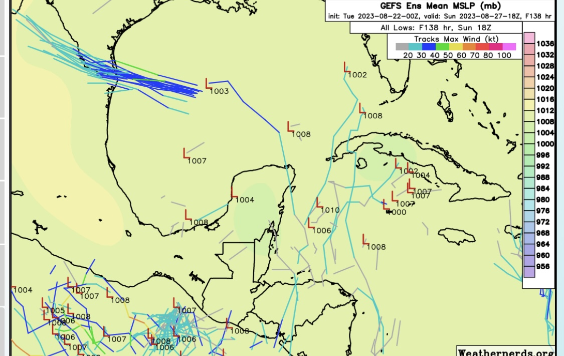
#SELAWX
Three day forecast and the coastal flood advisory. Unfortunately the little rain we’ve gotten has not put a dent in the drought. Nor has i...


